
Mapping Solution
Discover our comprehensive mapping solution that brings your environment to life. Harness the clarity of rich RGB imagery for detailed, true-to-life visualization, the precision of LiDAR for accurate 3D modeling, and the power of Digital Twin technology to create a dynamic digital reflection of your physical assets. These technologies provide a clear and cohesive view, enabling smarter planning, efficient monitoring, and more informed decision-making.

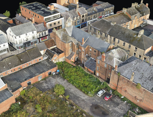
RGB Mapping
Experience the world in true color with our high-resolution RGB Mapping solution.
Our advanced sensors capture sharp, vibrant imagery that delivers life-like detail and precision, making it an essential tool for urban planning, asset tracking, and environmental assessment.
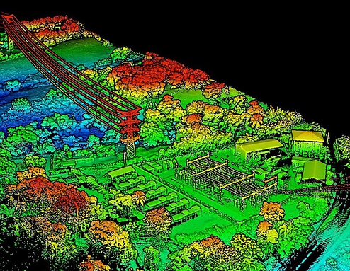
LiDAR Mapping
Unlock the three-dimensional world with our advanced LiDAR mapping solution. By emitting rapid laser pulses, our system captures ultra-dense, high-precision point cloud data to generate detailed 3D models of your environment.
Whether you're assessing infrastructure integrity or analyzing terrain for environmental projects
Digital Twin
Transform your physical assets into interactive, real-time digital replicas with our innovative Digital Twin solution.
Seamlessly integrating sensor data and analytics, this technology creates a living, virtual model of your environment, gaining actionable insights that streamline decision-making and optimize performance